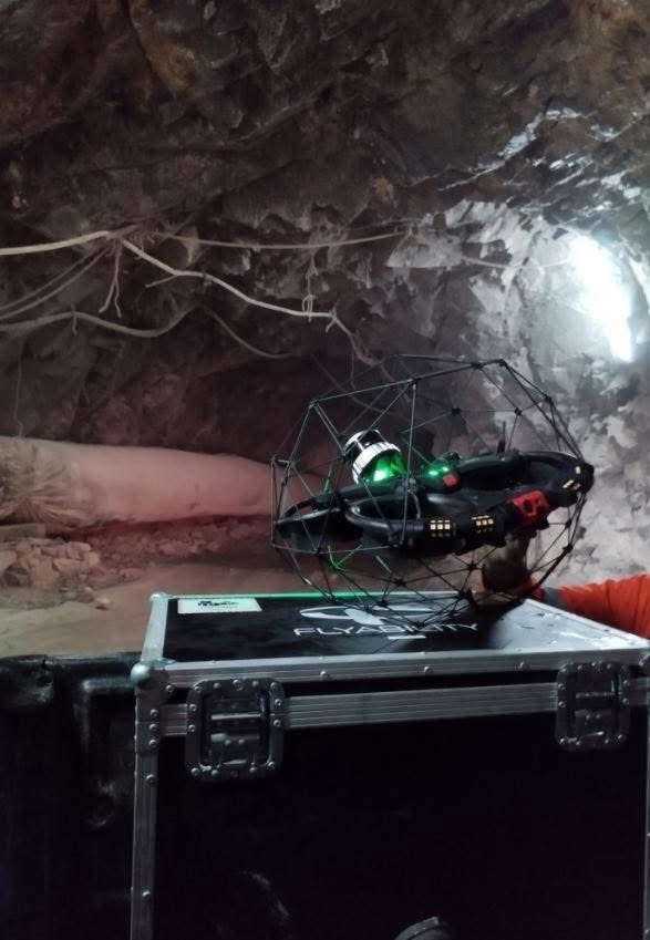
Underground mine mapping just got a whole lot faster with ELIOS 3 Drone
With the Elios 3 drone, you can map an 850m (2750ft) mine tunnel in just 9 minutes—capturing high-quality LiDAR and visual data, and without putting anyone at risk. Fly without GPS and BVLOS. Whether you’re tracking deformation, modeling stopes, surveying an ore pass, or checking for obstructions, the Elios 3 Surveying drone delivers reliable results with unmatched speed and safety.
Faster data. Safer inspections. More informed decision making.
Talk to our Elios experts, email us at sales@braamd.com or support@braamd.com to book a meeting or a live demo.