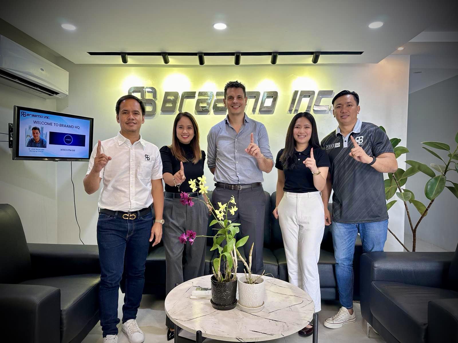
BRAAMD is thrilled to host at our HQ, Mr. Javier Garcia Lopez, Managing Director of the leading Systems Integrator in the industry 4.0 space , I4TECH. Exciting ideas were shared on how BRAAMD, through value-added Industry 4.0 solutions, can further strengthen and optimize the operations of our customers.
Looking forward to the development and realization of this collaboration.
Some days will be great, some days will not be. That’s just how life, or work, goes. We just have to get pass the not-so-great days, and cherish the better ones. Today, if you want it to be, it’s gonna be a great day!
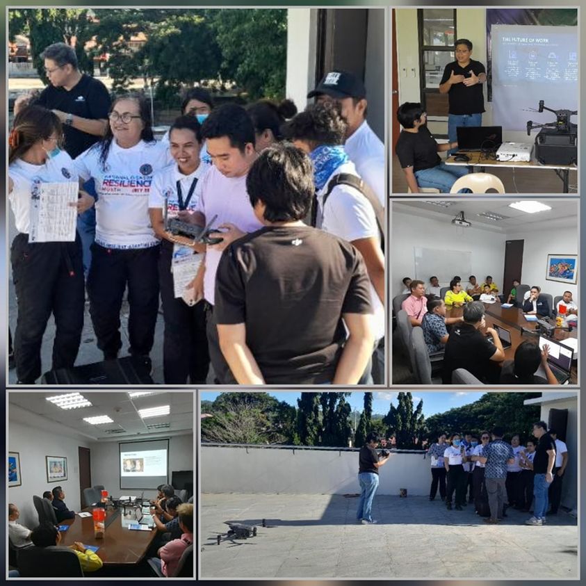
Braamd Inc., in collaboration with DJI Enterprise Philippines, hosts live demonstrations and detailed presentations of the latest, technologically advanced commercial drones for different industries and markets.
Our current DJI roadshow is happening in Cebu. Today, we kicked off our Cebu DJI Enterprise Drones Roadshow with a couple of presentations and demonstrations. Demo day like this gives our clients hands-on experience and appreciation of these high-tech mapping, industrial inspection, surveying, search & emergency services drones.
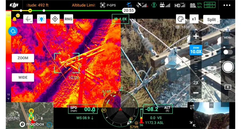
Firefighting: One of the most common uses of thermal drones is as firefighting tools. Heat mapping from the air allows firefighters to get ahead of risk factors. When working inside structures, it’s possible to map out possible points of failure, while in wildfire scenarios, drones can help crews intercept fires’ progress in the open.
Search and rescue: Fires aren’t the only types of disasters where thermal drones can assist rescue crews. In the aftermath of catastrophes such as floods, landslides, earthquakes, tornadoes and hurricanes, thermal drones can help crews find missing victims, even at night. These thermal UAVs are also capable of tracking down individuals who have become lost in the wilderness.
Aerial utility and mine drone inspections: Inspecting utility infrastructure, from plants and solar panel installations to far-flung power lines, is easier with drones. Using thermal cameras alongside conventional imaging allows crews to watch out for potential failure risks in new ways, or even inspect the status of thermal panels. No matter how large a plant or mine is, drones can fly over the site and take readings.
Advanced agriculture: Monitoring crops and grazing herds from the air is a potentially overlooked use for drones. Thermal imaging lets farmers measure fields’ heat exposure and track animals, even at night. Ongoing efforts to make farming more efficient through technology deployment are a perfect match for drone deployment.
Drone options: Find the best thermal drone for your purposes
While your choice of camera payload is important for thermal drone performance, so is the commercial drone chassis you pick. The right drone body will deliver the speed, maneuverability, service range, battery life and other traits that will determine what types of tasks your new thermal drone can accomplish.
The following are a few of the market-leading commercial drones you can choose from for your thermal deployment.
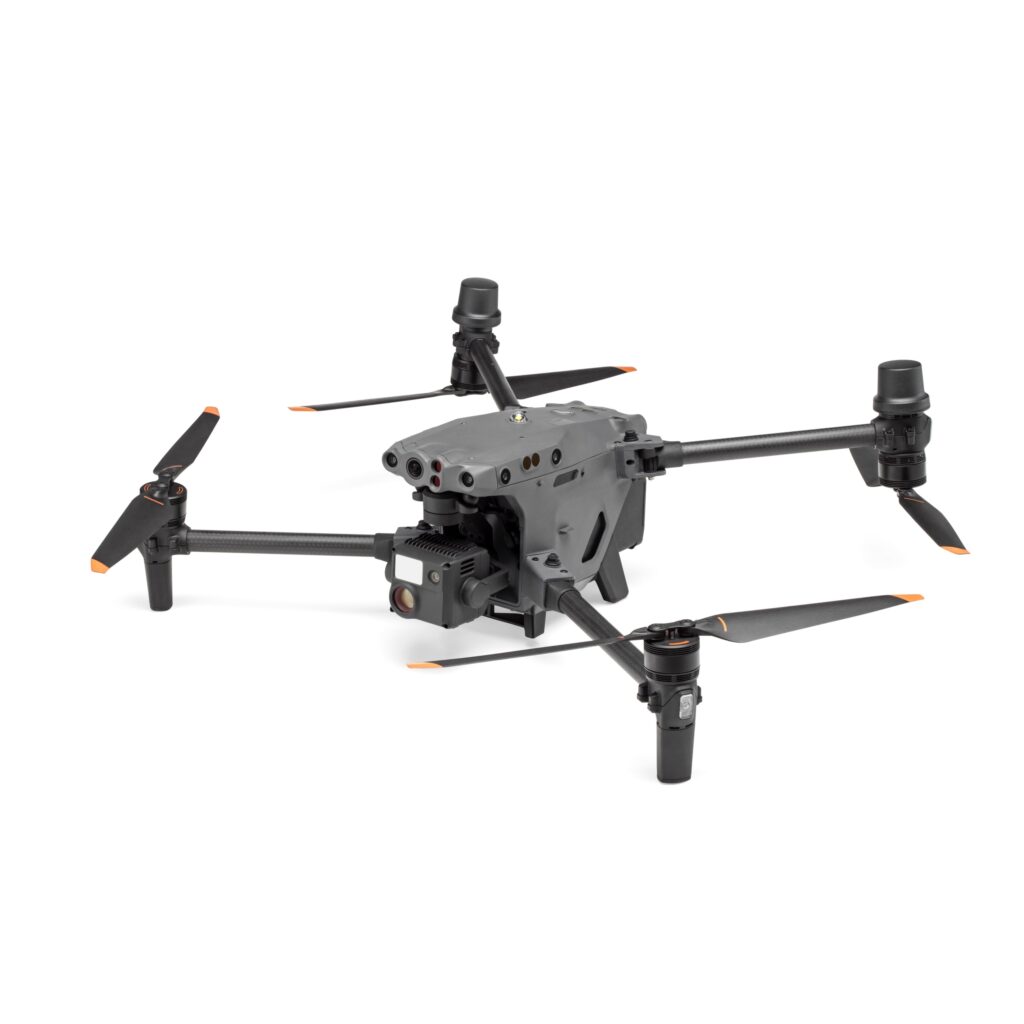
DJI Enterprise Matrice 30T Thermal Drone. The M30T is a tough drone chassis built to stand up to the elements and designed to be highly portable despite its impressive sensor payload. The control system for the M30T is especially advanced, with a 7-inch widescreen display on the dual-stick control system designed for enterprise drone pilot use.
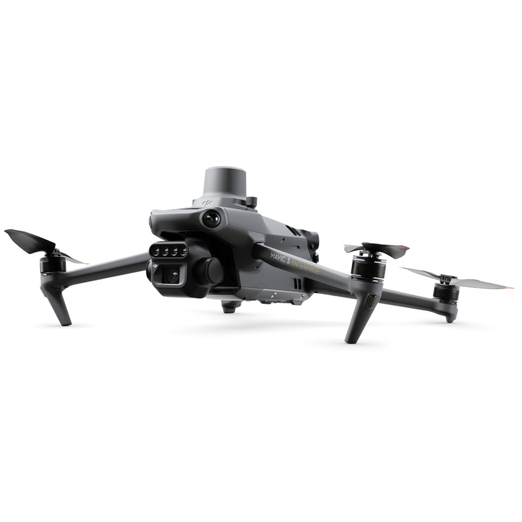
DJI Enterprise Mavic 3 Thermal Drone. See the Unseen. Mavic 3T’s thermal camera has 640 × 512 resolution and supports point and area temperature measurement, high temperature alerts, color palettes, and isotherms to help you find your targets and make quick decisions.
DJI Enterprise Matrice 350 RTK with Zenmuse H20T. Equipping the M300 RTK with a Zenmuse H20T or H20N as one of its payloads allows users to capture unprecedented levels of high-resolution thermal information.
In partnership with DJI Enterprise Philippines, we will be back in Cebu for more demo and showcase of the cutting-edge technology and solutions specific and targeted to industrial plants.
See you Cebu, get ready to fly, and to learn how drones revolutionize inspections, mapping, SAR, and more.
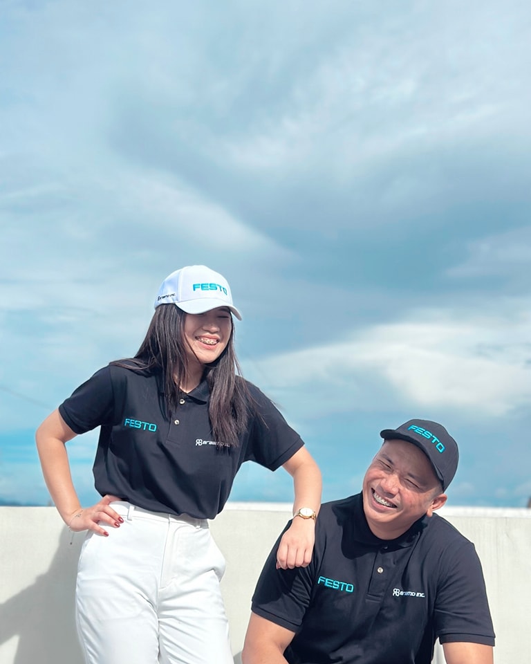
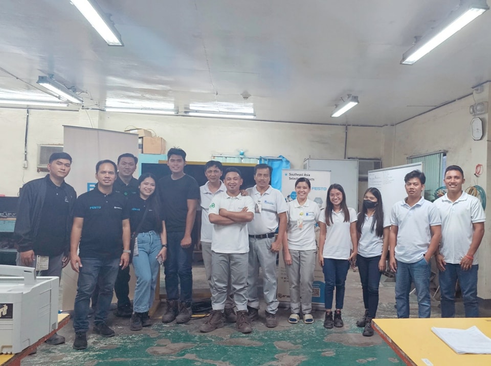
As part of our Corporate Social Responsibility, we provide Technology Education Program to students, clients, and our staff as well. Last week, led by our Festo Product Driver and Senior Sales Engineer, Mr. Xavier Burgos, we conducted a refresher course Basic Festo Pneumatic Training, for the I&C Department of our client.
For real-world learning experience, we have actual Festo demo units and training kits we use for these sessions. We also provide certificates for such training. To learn more about this T.E.P., to arrange seminars, trainings, other learning activities, and to collaborate with us, please contact [email protected].
Unilyte Rangle VRLA Battery – Ensuring longer service life for both standby & cyclic applications
EverExceed Unilyte range VRLA batteries adopt ultra high seismic resistance, can reach earthquake resistance level of 10. These batteries are constructed with the finest quality materials and state of the art manufacturing techniques, designed for standby & cyclic applications that require reliable power and long life.
What is RTK (real-time kinematics) and what it means for your drone?
With an RTK drone, surveyors and other kinds of enterprise drone pilots can expect centimeter-level positioning accuracy with each flight. The system represents a marked improvement from satellite data on its own and can help ensure you have the accurate information you need to get the job done.
What exactly is RTK?
Real Time Kinematics, or RTK for short, is a special technique for satellite positioning that can produce accurate results to the centimeter, making it an invaluable tool for surveyors around the world. The method involves measuring satellite data against a ground station for precise, real time information.
The key parts of the RTK technique include:
A base station: The RTK GNSS base station, also known as a reference station, remains at a defined point on the ground, where its GPS location is continually contrasted with the location of a drone. In order to work properly, an RTK drone must stay in constant connection with the base station.
RTK receiver: This device is a part of the hardware of the drone and sends signals to both the controller and a satellite.
A controller: Your drone’s remote controller sends signals to move the drone and displays coordinate changes.
Satellite: Satellite data is still a key part of any RTK system. However, rather than simply communicating with the drone receiver, information is also tested against the base station, establishing position accuracy.
The RTK advantage
RTK GPS data is far superior to satellite data on its own because it can be used to correct inaccuracies and discrepancies, ensuring information hews as close to reality as possible. There are numerous factors that can skew satellite coordinates, including incremental weather, tall buildings, mountains, and other issues calling for RTK correction. These are called “tropospheric delays.” The RTK system fills in these gaps with real time data from the base station and drone.
The major benefits of an RTK system include:
Improved accuracy: This is the big one. When compared to satellite data alone, an RTK system offers high accuracy — typically down to centimeter-level.
Real-time corrections: While other adjustment technologies like PPK (more on that below) correct skewed data and fill in gaps after a flight is completed, RTK corrections fix errors automatically. This means that the data you see during a flight is data you can trust.
Fewer ground control points: Ground control points are set spots on the ground with known coordinates that can be used to readjust GPS data. Laying out and measuring these points can be time-consuming. However, with RTK, the base station makes GCPs moot, allowing you to complete projects with significantly less hassle.
The difference between similar drones with and without RTK is startling. In one recent study, DJI and DroneDeploy compared the Phantom 4 RTK and Phantom 4 Pro (a consumer edition that does not have a built-in RTK receiver) over more than 30 different flights with a control point system for a rooftop building survey. The results showed that the RTK-enabled drone calculated horizontal and vertical accuracy of the measured points better, as well as the accuracy of linear measurements.
Getting the most out of your RTK hardware
If you’re looking for an RTK system that’s reliable for each and every flight, you’ll want an enterprise drone from DJI. Our RTK systems utilize an on-drone module and a high-precision GNSS Mobile Station. The combination of onboard RTK receiver and GNSS signal reference station delivers a high degree of RTK accuracy. Whether you elect to rely fully on RTK or also have PPK capabilities as a backup, using a DJI drone means you can expect to stay connected no matter the mission.
The Matrice 30 takes everything the Matrice 300 has, and packs it into a portable package. With a smaller footprint and weight, the Matrice 30 is far easier to take along for your inspection missions. With built in RTK modules, it’s the perfect solution if you need to conduct precise drone inspections of assets or infrastructure that require centimeter-level accuracy.
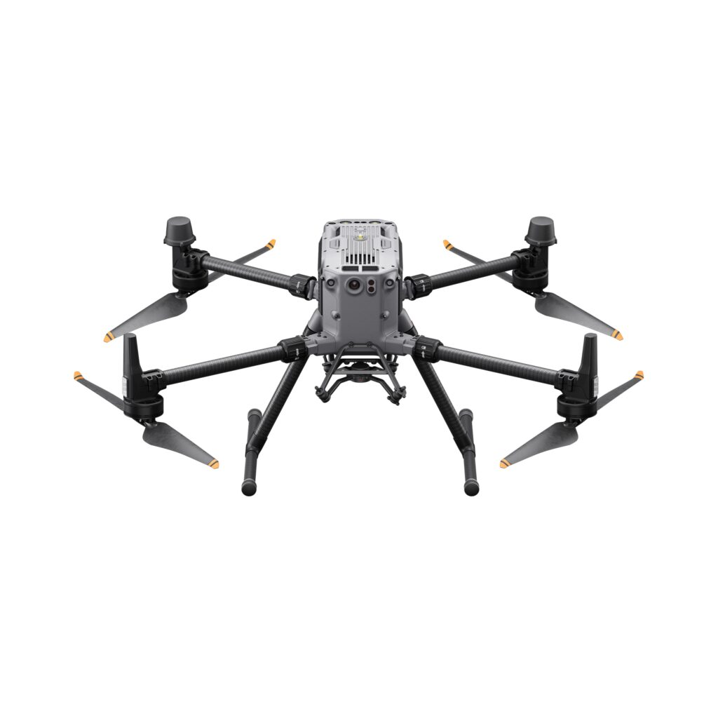
Welcome to the future of commercial drones. The Matrice 350 RTK accentuates its advanced RTK positioning system with advanced AI capabilities and six directional sensing positioning. Add in a 55 minute maximum flight time, hot-swappable batteries, and a wide-ranging operating temperature and you get a drone that’s ready for any job you can throw at it.
The Mavic 3 Enterprise Series redefines industry standards for small commercial drones. With a mechanical shutter, a 56× zoom camera, and an RTK module (sold separately) for centimeter-level precision, the Mavic 3E brings mapping and mission efficiency to new heights.
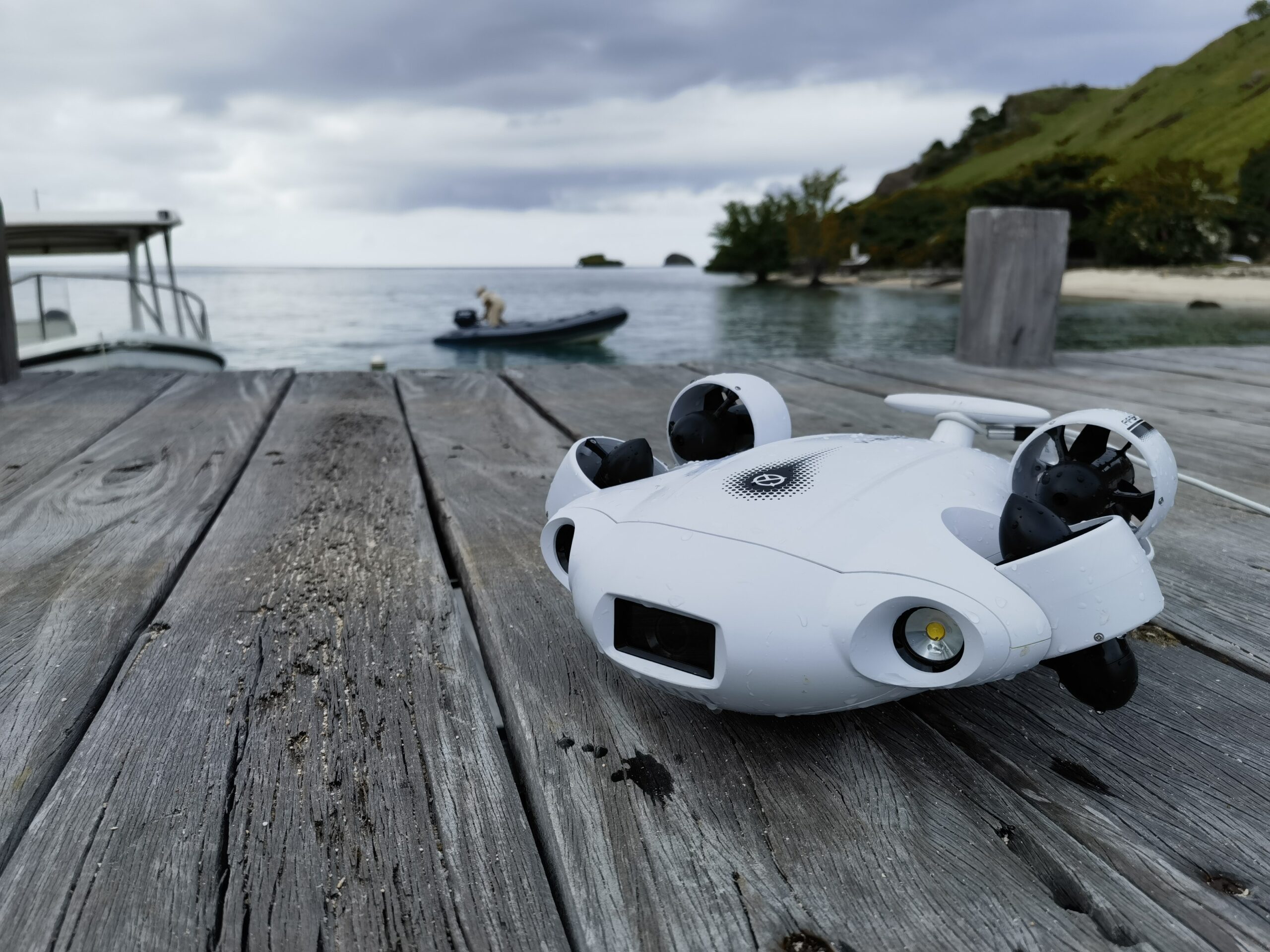
See the bigger picture and discover an extraordinary world below. Go beyond a conventional underwater lens to achieve a greater impact with your visuals.
Real-time Color Balance & Image Enhancements
QYSEA’s self-developed and adaptive imaging system lets you see the underwater world in its true vivid colors, with dynamic reduction of noise reduction. Maximize your underwater vision with FIFISH V-EVO, wherever your dives take you.
Adaptive AI Sea Plankton Filtering Algorithm
Using intelligent imaging algorithms, FIFISH V-EVO naturally filters out white marine flakes caused by plankton and bacteria. Create your cinematic shots with maximum smoothness and clarity.
5000 Ultra-bright Lumen LEDs
FIFISH V-EVO comes equipped with a pair of combined 5000 lumens · 5500K white LED lights. Optimize your vision across the deep sea and restore the colors of the world below, especially through dark and turbid environments.
Move & film with absolute freedom underwater
Reach beyond the limits of traditional methods, achieve full 360° freedom in underwater mobility, hovering and posture holds. Turn your creative imagination into cinematic 4K imaging reality.
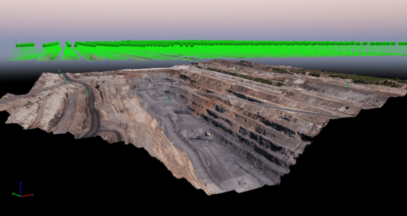
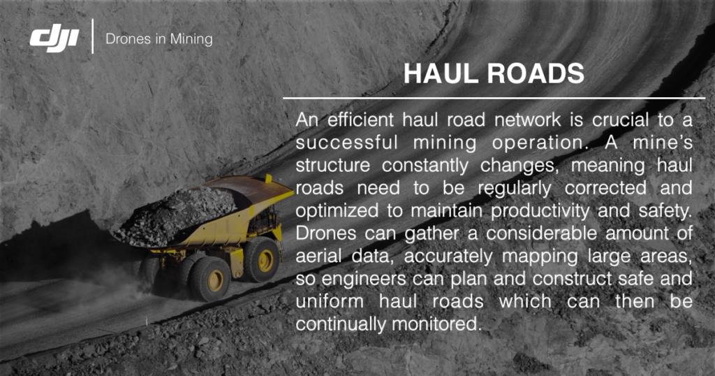
An efficient haul road network is crucial to a successful mining operation. A mine’s structure constantly changes, meaning haul roads need to be regularly corrected and optimized to maintain productivity and safety. Drones can gather a considerable amount of aerial data, accurately mapping large areas, so engineers can plan and construct safe and uniform haul roads which can then be continually monitored.
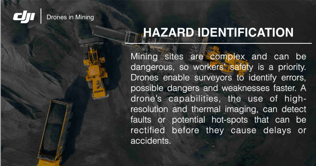
HAZARD IDENTIFICATION
Mining sites are complex and can be dangerous, so workers’ safety is a priority. Drones enable surveyors to identify errors, possible dangers and weaknesses faster. A drone’s capabilities, the use of high-resolution and thermal imaging, can detect faults or potential hot-spots that can be rectified before they cause delays or accidents.
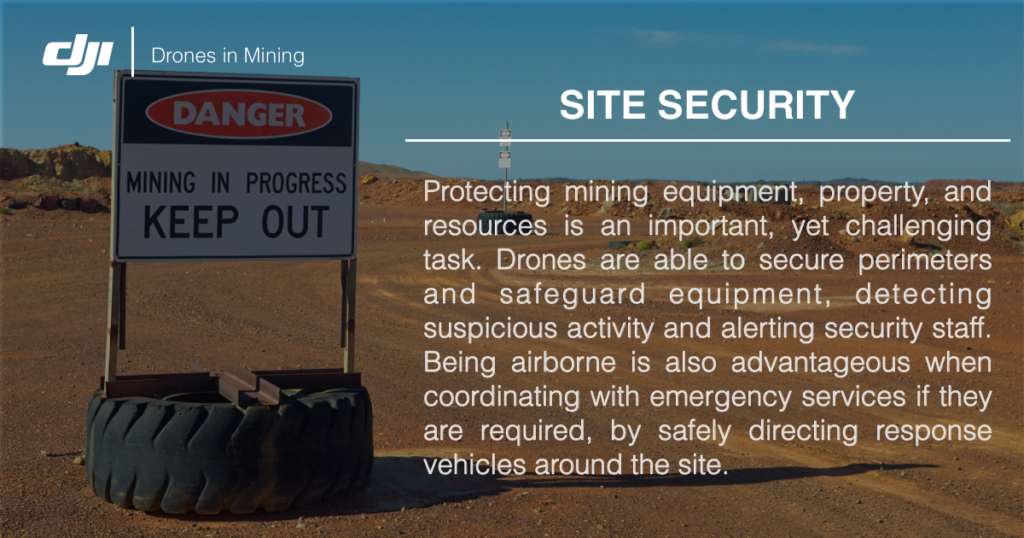
SITE SECURITY
Protecting mining equipment, property, and resources is an important, yet challenging task. Drones are able to secure perimeters and safeguard equipment, detecting suspicious activity and alerting security staff. Being airborne is also advantageous when coordinating with emergency services if they are required, by safely directing response vehicles around the site.
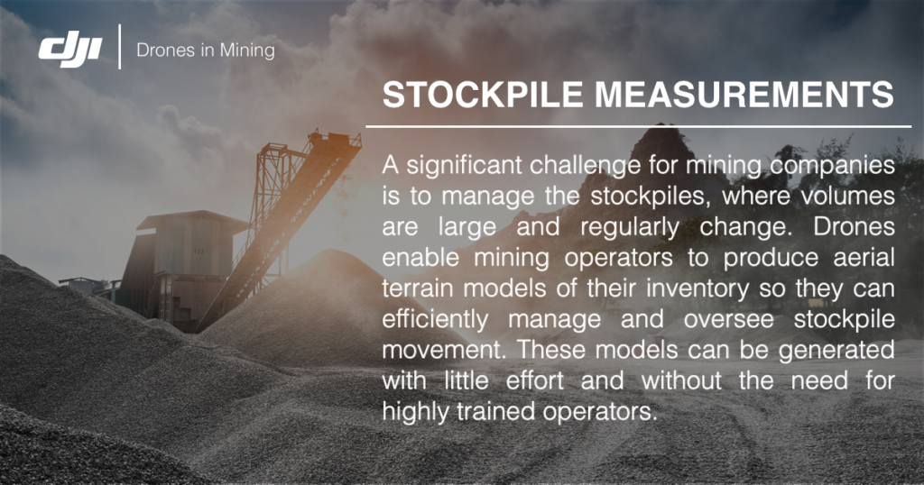
STOCKPILE MEASUREMENTS
A significant challenge for mining companies is to manage the stockpiles, where volumes are large and regularly change. Drones enable mining operators to produce aerial terrain models of their inventory so they can efficiently manage and oversee stockpile movement. These models can be generated with little effort and without the need for highly trained operators.