DJI Enterprise Drones for City/Municipal Applications
Urban Planning.
Drone data creates accurate 2D and 3D models that integrate seamlessly with local geographic information systems, helping teams visualize results. Use for for city modeling, urban-rural classification, and corridor mapping.
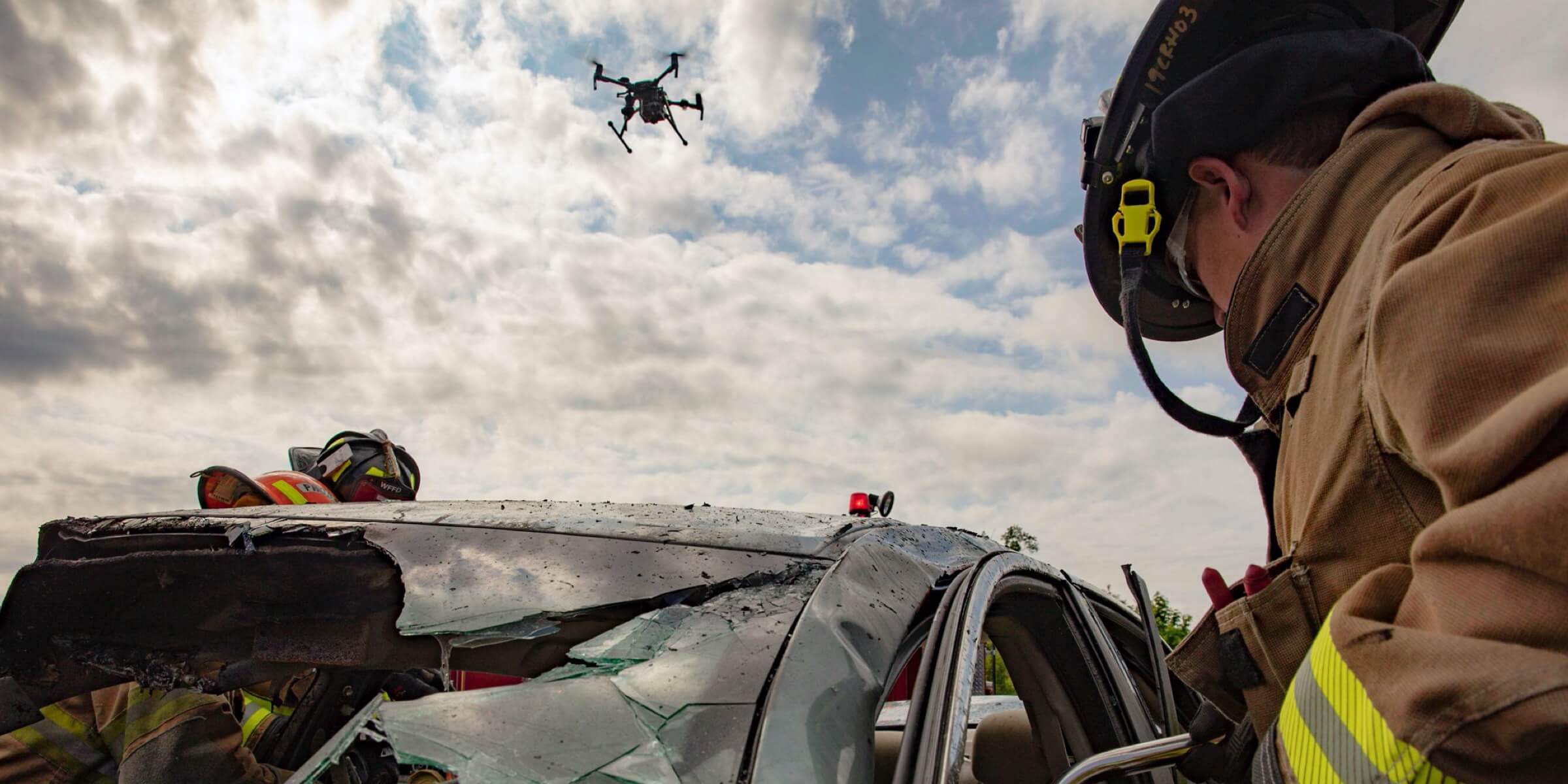
Use for public safety.
Respond effectively with aerial information. Direct aid Where it is needed most. Respond to urgent missions with rapid aerial awareness. Eliminate guesswork and act with assurance.
Use in firefighting, law enforcement, rescue services, and more.
Land Surveying.
Drone solutions collect accurate, geo-tagged data quickly, while photogrammetry software processes these data to deliver standardized outputs. Map and model large areas quickly with drones to produce data for accurate 2D and 3D models.
Construction Planning and Design.
Drone data can be used to create accurate 2D and 3D models in aerial site surveys to streamline planning and inform design. Project teams can rely on drone solutions to efficiently visualize reality and collect surveying data needed to evaluate large worksites.
Construction Management.
Drone solutions help manage every step of the construction process to monitor progress, reduce risks, and keep personnel safe.
Natural Resource Management.
Deploy drones with high-resolution visual sensors and multispectral sensors to map forests, sample vegetation, or monitor and manage the health of forests and wildlife. Map around surface water, outfalls and more with drones to obtain data on-demand, facilitating resource management and compliance monitoring across vast areas. Use for forest management, water resource management, etc.