Top Features of DJI Dock 2
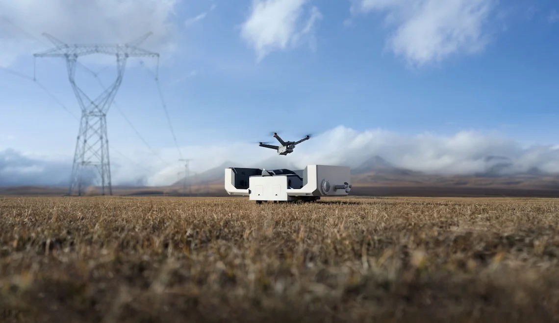
DJI Dock 2, a revolutionary advancement in remote drone operations. Building on the success of its predecessor, Dock 2 brings a plethora of unique features and capabilities that are poised to transform emergency response, construction management, surveying, and asset inspection. It’s the ultimate solution for enterprises that seek uncompromising performance for their remote drone operations.
Easy to Deploy
The DJI Dock 2 is remarkably easy to deploy. It is physically smaller and is approximately 70% reduction in both size and weight compared than its predecessor making it easily transportable by two individuals.
Diverse Payload Options
The new DJI Matrice 3D and Matrice 3TD are custom-made to work with Dock 2. The M3D is equipped with a telephoto camera and a wide-angle camera with a mechanical shutter that captures images of exceptional quality – perfect for high-precision mapping tasks. The M3TD is equipped with a telephoto camera, a wide-angle camera, and an infrared camera.
Cost-efficient
DJI Dock 2 stands out for its cost-efficiency. Compared with similar solutions, it offers superior performance. Because of its compact size, transportation to a work site and maintenance of the system are significantly lowered.
Rugged, Reliable, Recharged
DJI Dock 2 is IP55 dust and water-resistance rated, allowing it to operate in the extreme climates and environments. Each drone can operate in the sky for a maximum of 50 minutes.
Rapid Takeoff
Time is of the essence for first responders who need to get their eyes in the sky. DJI understands this better than anyone. With next-generation image recognition algorithms and Real-time Kinematics(RTK) positioning techniques, the M3D and M3TD can take off from Dock 2 in as little as 45 seconds.
Precise Landing Capabilities
The Dock 2 has advanced image recognition technology that enables it to precisely identify positioning markers on the landing pad, ensuring a quick and safe landing.
Remote Live flight Control & Live Stream
FlightHub 2 allows operators to access remote live flight control, providing real-time oversight and management of their drone’s operations.
Third-part Payloads & Waypoint Mission FPV
Using high-precision 3D models, pilots can edit visual flight routes from a first-person perspective, preview simulated imaging results, and simplify the setting and navigating of flight paths through waypoint mission FPV capabilities.
Cloud Mapping
Cloud mapping has become much easier. Operators no longer need to download DJI Terra for model processing; they can create a 3D model directly through FlightHub 2.
