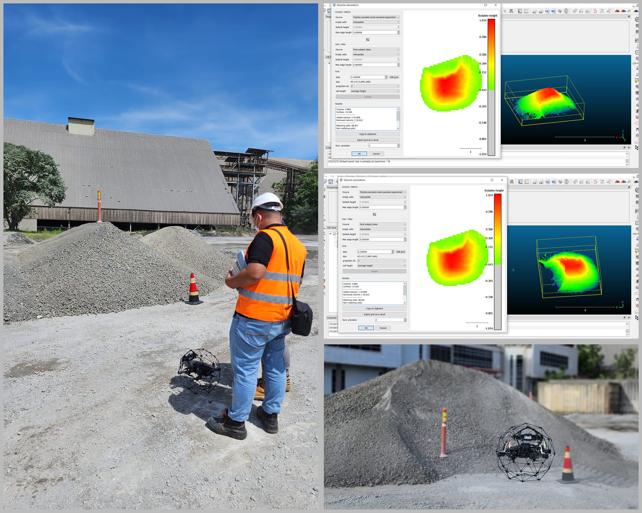
Monitoring stockpiles with ELIOS drone with LIDAR payload and CloudCompare
While Flyability Elios 3 is primarily intended for , it can also be used for mapping applications in mining, cement, to industrial asset management, including stockpile measurements.
Benefits:
Flying the Elios 3 is a one person operation, compared to Laser scanning which usually requires 1-2 surveyors.
In terms of time-saving on-site for data capture, the Elios is more effi cient. Data processing is also more e fficient and simpler.
The Elios 3 removes the need for surveyors to climb stockpiles.
More flexibility in when to conduct the stockpile flights.
Data capture can be done when the stockpile area is in full operation.
More control over and ownership of the stockpile data.
Easy-to-use software and workflows to follow. Less expertise is required.
Reduction of costs for the plant when conducted internally and not outsourced.
Results can be computed within the hour instead of waiting days for the reports
Finally, there is a far better improvement in the ROI.
We have done flights, tests and volume calculations using Elios 3 and CloudCompare. Feel free to contact us if you would like to test this Drone-Lidar-Software solution in your plant and stockpiles.
We look forward to speaking with you soon. Also, you may email us to request for a Case Study about this.
Email: sales@braamd.com, support@braamd.com