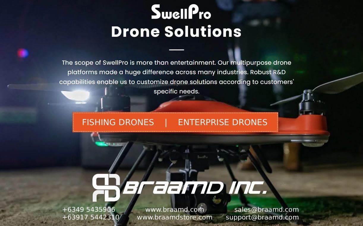
DJI Enterprise Drones For Mining

Posted on
Drones For Mining

DJI Enterprise Drones For MiningOptimized Planning, Management and Safety

Why use DJI Enterprise drones in mining?

From measuring stockpiles, surveying, and mapping, to managing safety and security, drone applications in the mining industry are growing rapidly. Drones streamline operations by creating accurate site models, assessing risks remotely, and eliminating the need for costly manned aircraft and expert personnel.

Drones offer smart oversight of all operations and improved savings and efficiency, with data being produced on-site at a fraction of the cost of traditional surveying techniques.

The benefits of integrating drones to mining operations

ENHANCED SAFETY. Operating in one of the most dangerous industries, mining companies have to run regular inspections and maintain site and equipment certifications up-to-date. Drones ensure people remain out of harm’s way by accessing and assessing volatile and hazardous areas remotely.

POWERFUL DATA. Mining operations have to manage an enormous amount of survey data, so accuracy is vital. Drones capture high-end ortho-images that create extremely realistic ‘digital twin’ 3D models of external sites as well as deep mines; allowing planning for future expansion and detecting structural weaknesses.

EFFICIENCY GAINS. Quickly capture aerial data of large worksites and replace tedious or time-consuming manual processes with drones. A more efficient, cost-effective and safe inspection process, that simplifies operations, providing enhanced monitoring and control. Remote slope stability checks, quick risk assessment and frequent, safe surveys all mean reduced downtime.

In the Philippines? Buy your DJI Enterprise Drones here.

Elios 3 Surveying Payload: Everything you need to know (Video)

Posted on
ELIOS 3 SURVEYING PAYLOAD - Surveying the inaccessible

Elios 3 Surveying Payload: Everything you need to know (Video)

This is the Elios 3 Surveying Payload, the next revolution in 3D data capture by Flyability, enabling users to safely create centimeter accurate scans of hard-to-reach areas, with the Elios 3 Surveying Payload. Join Michael Blake, Product Manager from the Flyability team, as he provides a comprehensive overview of the payload. From specifications and demos to comparisons and upgrades, here’s everything you need to know about the Elios 3 Surveying Payload.

Request for ELIOS 3 Survey Payload pricing here.

Dwyer Instruments: Room status monitors and room pressure monitors

Posted on
DWYER Room and Pressure Monitors

Dwyer Instruments: Room status monitors and room pressure monitors

Room status monitors and room pressure monitors are designed for critical low differential pressure applications that require stringent pressure, relative humidity, temperature, air change, and/or door status monitoring and alarming. Applications include pharmaceutical manufacturing, semiconductor manufacturing, clean rooms, hospital isolation rooms, research labs, vivariums, and clean manufacturing areas.

SERIES RSM

For Sensing Low Pressure Using High Accuracy
Room Status Monitor is designed for critical differential pressure applications that need pressure monitoring and alarming. Applications include manufacturing, clean rooms, research labs, and pharmaceutical.

SERIES RPME

Room Status Indication, Magnehelic® Gage Size
Room Pressure Monitor is designed for low differential pressure applications, configure to positive or negative pressure in protected environments and clean manufacturing areas.

Dwyer SERIES RSMC STABILISENSE™ CRITICAL ROOM STATUS MONITOR

SERIES RSMC

Touchscreen LCD, Monitors Multiple Parameters
StabiliSENSE™ Critical Room Status Monitor

DWYER SERIES RSME ROOM STATUS MONITOR

SERIES RSME

Touchscreen LCD, Monitors Multiple Parameters
Designed for low differential pressure applications that require stringent pressure monitoring and alarming.

As Festo Partner, Why Choose Us?

Posted on
As Festo Partner, Why Choose Us?

As Festo Partner, Why Choose Us?

As Festo’s Official Partner, we can support you in various ways such as product availability, competitive pricing, technical services, application advice on site, pneumatics mapping, support for commissioning, process automation, system integration and Festo Energy Saving Services.

We have Senior Sales and Application Engineers nationwide , who are eager to visit you to discuss and review your requirements.

See us for free consultation, mapping and training.

ELIOS 3 Surveying Payload (Video)

Posted on

ELIOS 3 Surveying Payload (Video)

Flyability’s Surveying Payload turns the Elios 3 into a flying mobile scanner that can fit through openings as small as 50x50cm, and create high resolution scans beyond line of sight, allowing industry professionals to provide rapid insights that are not accessible with traditional tools or other UAV technologies.

Elios Surveying Payload

DJI Zenmuse L2: Everything You Need To Know (Video)

Posted on
DJI Zenmuse L2: Everything You Need To Know (Video)

DJI Zenmuse L2: Everything You Need To Know (Video)

This is DJI Zenmuse L2, our latest highly integrated LiDAR system for precise and accurate 3D data collection. DJI Enterprise team explains the Zenmuse L2 in detail. From specs, and comparisons to upgrades, here’s everything that you need to know about our latest LiDAR payload, DJI Zenmuse L2.

DJI Zenmuse L2 (Video)

Posted on
DJI Zenmuse L2 (Video)

DJI Zenmuse L2 (Video)

Introducing DJI Zenmuse L2, our latest highly integrated LiDAR system designed for precise and accurate 3D data collection. The Zenmuse L2 integrates a 4/3 CMOS RGB mapping camera, a Livox LiDAR module, and a high-accuracy IMU, all on a 3-axis stabilized gimbal. It can scan complex objects within an extended range and generate accurate point clouds faster. With a detection range of up to 250 meters and a reduced laser spot size, it can detect smaller and more detailed objects, even in dense vegetation, resulting in more accurate digital elevation models. The Zenmuse L2 supports up to 5 returns, enhancing the capability to collect bare earth data. In addition, it supports two scanning modes, making it ideal for precise topographical survey scans. The IMU requires no warm-up time, allowing users to capture data immediately after powering it on. The Zenmuse L2 can capture LiDAR and photogrammetry data simultaneously while maintaining True Color LiDAR data. It’s the perfect tool for professionals in various industries, including surveying and mapping, energy, forestry, and construction.

DJI Zenmuse L2

Posted on
DJI Zenmuse L2

DJI Zenmuse L2

Introducing the DJI Zenmuse L2, our latest highly integrated LiDAR system designed for precise and accurate 3D data collection.

The Zenmuse L2 integrates a 4/3 CMOS RGB mapping camera, a Livox LiDAR module, and a high-accuracy IMU, all on a 3-axis stabilized gimbal. It can scan complex objects within an extended range and generate accurate point clouds faster. With a detection range of up to 250 meters and a reduced laser spot size, it can detect smaller and more detailed objects, even in dense vegetation, resulting in more accurate digital elevation models.

The Zenmuse L2 supports up to 5 returns, enhancing the capability to collect bare earth data. In addition, it supports two scanning modes, making it ideal for precise topographical survey scans. The IMU requires no warm-up time, allowing users to capture data immediately after powering it on.

The Zenmuse L2 can capture LiDAR and photogrammetry data simultaneously while maintaining True Color LiDAR data. It’s the perfect tool for professionals in various industries, including surveying and mapping, energy, forestry, and construction.

Click here for more info: https://brnw.ch/21wDiIV

DJI Enterprise Drones for City/Municipal Applications

Posted on
DJI Enterprise Drones for City/Municipal Applications

DJI Enterprise Drones for City/Municipal Applications

Urban Planning.
Drone data creates accurate 2D and 3D models that integrate seamlessly with local geographic information systems, helping teams visualize results. Use for for city modeling, urban-rural classification, and corridor mapping.

Use for public safety.
Respond effectively with aerial information. Direct aid Where it is needed most. Respond to urgent missions with rapid aerial awareness. Eliminate guesswork and act with assurance.
Use in firefighting, law enforcement, rescue services, and more.

Land Surveying.
Drone solutions collect accurate, geo-tagged data quickly, while photogrammetry software processes these data to deliver standardized outputs. Map and model large areas quickly with drones to produce data for accurate 2D and 3D models.

Construction Planning and Design.
Drone data can be used to create accurate 2D and 3D models in aerial site surveys to streamline planning and inform design. Project teams can rely on drone solutions to efficiently visualize reality and collect surveying data needed to evaluate large worksites.

Construction Management.
Drone solutions help manage every step of the construction process to monitor progress, reduce risks, and keep personnel safe.

Natural Resource Management.
Deploy drones with high-resolution visual sensors and multispectral sensors to map forests, sample vegetation, or monitor and manage the health of forests and wildlife. Map around surface water, outfalls and more with drones to obtain data on-demand, facilitating resource management and compliance monitoring across vast areas. Use for forest management, water resource management, etc.