Description
DJI ZEMUSE L1
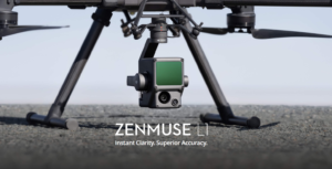
Zenmuse L1
Instant Clarity. Superior Accuracy.
A Lidar + RGB Solution for Aerial Surveying
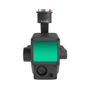
The Zenmuse L1 integrates a Livox Lidar module, a high-accuracy IMU, and a camera with a 1-inch CMOS on a 3-axis stabilized gimbal. When used with Matrice 300 RTK and DJI Terra, the L1 forms a complete solution that gives you real-time 3D data throughout the day, efficiently capturing the details of complex structures and delivering highly accurate reconstructed models.
- Integrates a Lidar module, an RGB camera, and a high-accuracy IMU
- High Efficiency 2 km2 covered in a single flight [1]
- High AccuracyVertical Accuracy: 5 cm / Horizontal Accuracy: 10 cm [2]
- Point Rate: 240,000 pts/s
- Supports 3 Returns [3]
- Detection Range: 450 m (80% reflectivity, 0 klx)
- IP54 Ingress Protection Level
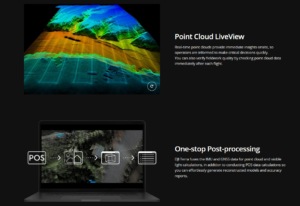
- Point Cloud LiveView
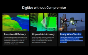
Digitize without Compromise
- Exceptional Efficiency. Generate true-color point cloud models in real-time, or acquire 2 km2 of point cloud data in a single flight [1] using the Livox frame Lidar module with a 70° FOV and a visible light camera with a 1-inch sensor.
- Unparalleled Accuracy. Render centimeter-accurate reconstructions thanks to the high-accuracy IMU, a vision sensor for positioning accuracy, and the incorporation of GNSS data.
- Ready When You Are. The IP54 rating allows the L1 to be operated in rainy or foggy environments. The Lidar module’s active scanning method enables you to fly at night.
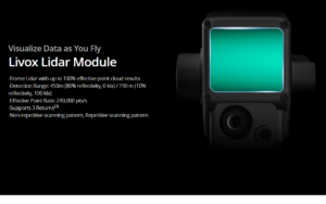
Visualize Data as You Fly. Livox Lidar Module.
- Frame Lidar with up to 100% effective point cloud results
- Detection Range: 450m (80% reflectivity, 0 klx) / 190 m (10% reflectivity, 100 klx)
- Effective Point Rate: 240,000 pts/s
- Supports 3 Returns[3]
- Non-repetitive scanning pattern, Repetitive scanning pattern
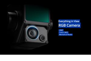
Everything in View. RGB Camera.
- 20MP
- 1-inch CMOS
- Mechanical Shutter
Accurate Details at Your Disposal. High-accuracy IMU.
- Vision Sensor for Positioning Accuracy
- GNSS, IMU, RGB Data Fusion
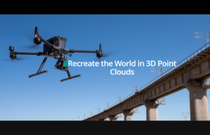
Recreate the World in 3D Point Clouds
- Point Cloud LiveView. Real-time point clouds provide immediate insights onsite, so operators are informed to make critical decisions quickly. You can also verify fieldwork quality by checking point cloud data immediately after each flight.
- One-stop Post-processing. DJI Terra fuses the IMU and GNSS data for point cloud and visible light calculations, in addition to conducting POS data calculations so you can effortlessly generate reconstructed models and accuracy reports.
Applications
- Topographic Mapping
- AEC and Surveying
- Emergency Response
- Law Enforcement
- Energy and Infrastructure
- Agriculture and Forestry Management
Related Links:
Footnotes:
[1] Over 30 minutes, at a speed of 13 m/s, a flight altitude of 100 m, with a side overlap rate of 10%, point cloud density > 100 points/m2.
[2] The accuracy was measured after a 5-minute warm up, using Mapping Mission with Calibration Flight enabled in DJI Pilot, and with the RTK in FIX status. The relative altitude was set to 50 m, flight speed to 10 m/s, gimbal pitch to -90°, and each straight segment of the flight route was less than 1000 m. DJI Terra was used for post-processing.
[3] In operations with two or three returns, the point rate is 480,000 pts/s