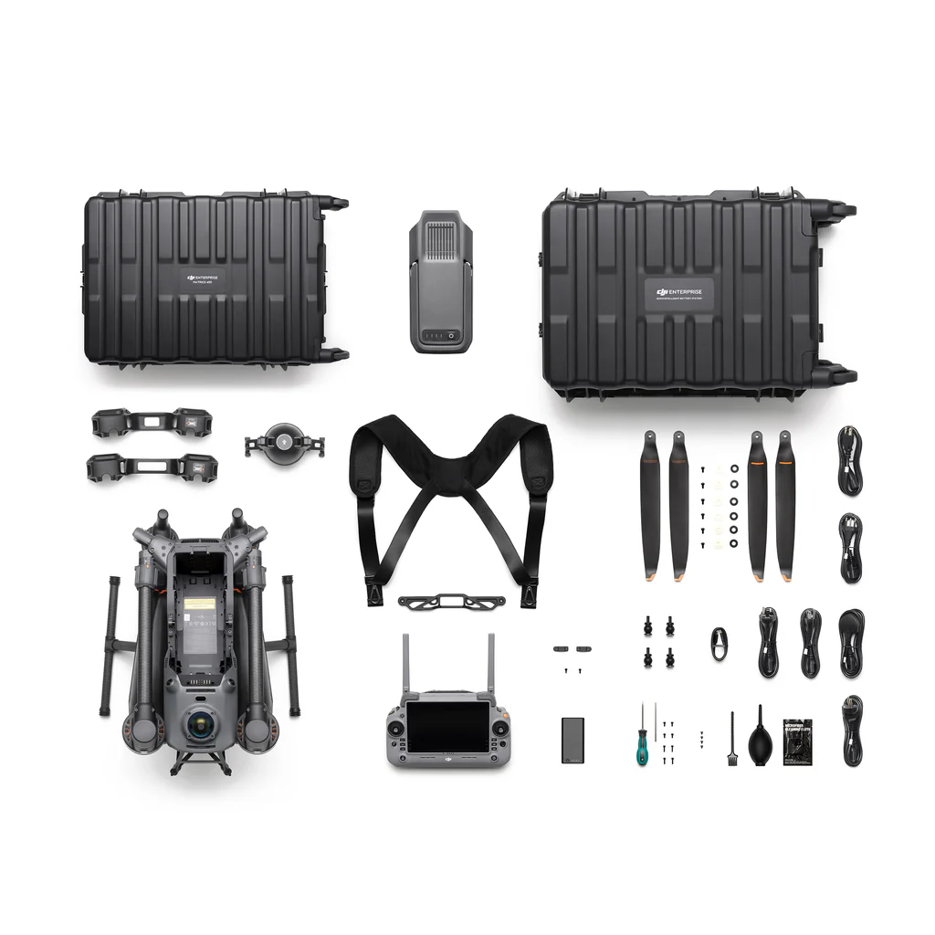
Description
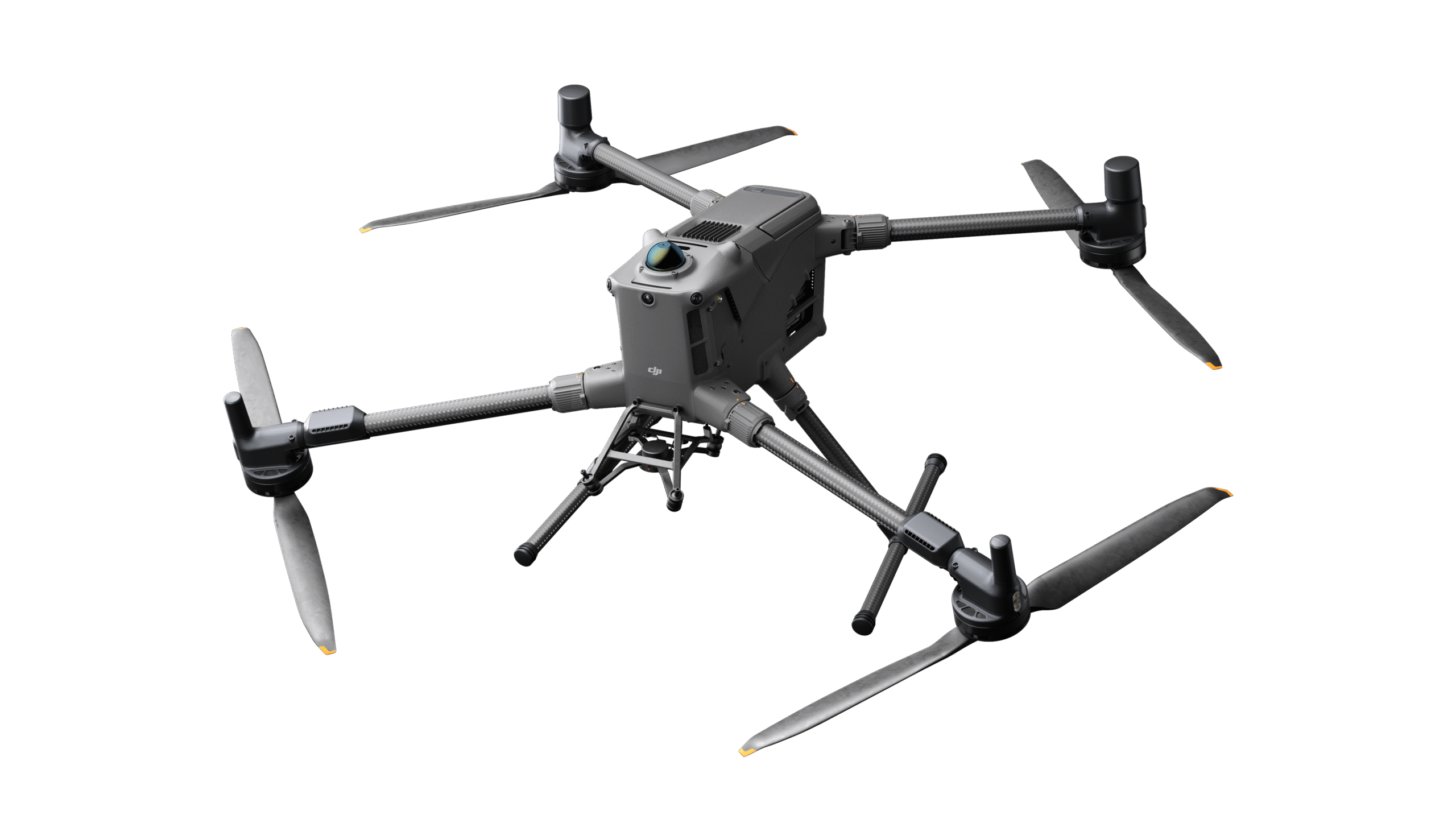
DJI DJI Matrice 400
Specifications:
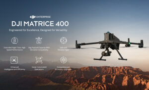
Next-Generation Enterprise Flight Performance
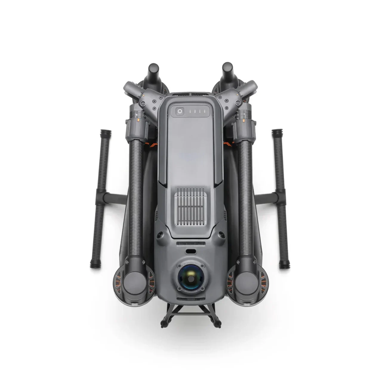
The DJI Matrice 400 is designed as a heavy-duty enterprise aerial platform built for demanding industrial, inspection, and public safety missions. It delivers high payload flexibility, extended flight endurance, and enhanced stability in complex environments such as urban corridors, coastal zones, and disaster sites. Its modular architecture supports multiple payload configurations, allowing operators to switch between thermal imaging, zoom inspection, LiDAR, and multisensor gimbals depending on mission needs.
Smarter AI-Assisted Operations
The Matrice 400 integrates advanced onboard AI capabilities for real-time detection and classification of vehicles, vessels, infrastructure defects, and human subjects. It supports intelligent subject tracking, automated waypoint adaptation, and mission-aware flight behavior, improving efficiency in search and rescue, surveillance, and industrial inspection workflows. AI models can be updated or expanded to support specialized operational scenarios.
Extended Sensing and Obstacle Avoidance
A full-direction sensing system provides omnidirectional environmental awareness using a combination of vision sensors, radar-assisted detection, and low-light navigation cameras. This enables precise obstacle avoidance, safe rerouting, and stable hovering even in GPS-challenged or visually degraded environments such as smoke, fog, or night operations.
High-Precision Positioning with RTK Navigation
Equipped with an integrated RTK module, the Matrice 400 delivers centimeter-level positioning accuracy for mapping, surveying, and inspection tasks. The GNSS+Vision Fusion Navigation System ensures reliable flight stability and safe return-to-home functionality even in environments with weak or obstructed satellite signals, such as dense urban infrastructure or mountainous terrain.
Advanced Imaging and Payload Versatility
The platform supports a wide range of interchangeable payloads including high-resolution optical zoom cameras, thermal sensors, and hybrid multi-sensor gimbals. This flexibility enables applications such as infrastructure inspection, wildfire assessment, powerline monitoring, and border surveillance. Enhanced gimbal stabilization ensures sharp, distortion-free imaging even at high zoom levels.
Low-Light and Night Operations Capability
Optimized for 24/7 deployment, the Matrice 400 features enhanced low-light vision sensors and optional infrared illumination modules. These systems improve visibility in dark environments, supporting search and rescue missions, perimeter monitoring, and wildlife protection during nighttime operations.
Intelligent Mapping and Survey Efficiency
The aircraft supports advanced aerial mapping modes including automated grid capture, oblique imaging, and real-time 3D reconstruction workflows. With high-speed interval shooting and optimized flight path planning, it significantly reduces mission time while improving spatial data accuracy for surveying and construction applications.
Real-Time Data Transmission and Collaboration
A next-generation transmission system provides long-range, low-latency HD video and telemetry streaming. Integration with fleet management platforms allows real-time mission sharing, collaborative control, and cloud-based data access for teams operating across multiple locations.
Industrial-Grade Reliability and Safety Systems
Built for harsh environments, the Matrice 400 includes redundant flight systems, reinforced structural design, and intelligent battery management for improved operational safety. Automated health diagnostics and predictive maintenance alerts help reduce downtime and ensure mission readiness.
Smart Mission Automation
With support for autonomous route planning, terrain-following flight, and dynamic obstacle adaptation, the Matrice 400 reduces operator workload while increasing mission precision. It can execute complex multi-point inspections and return-to-home actions intelligently even under degraded signal conditions.
Emergency Response and Public Safety Optimization
Designed with emergency operations in mind, the system supports rapid deployment, target highlighting, and real-time situational awareness sharing. It is optimized for disaster response scenarios such as floods, earthquakes, wildfire monitoring, and urban rescue coordination.